- 3D scanning: Collecting data about the shape an appearance of a physical object, structure, and environment. CNC uses Trimble SX10 scanners to capture steel and concrete under construction as well as inaccessible topographic survey features.
- Acre: Area equal to 43,560 square feet. In the Public Land Survey System, 640 acres make up a square mile or section. Original sections were laid out with eighty 66? long chains. A section of land is 80 chains (one mile) x 80 chains (one mile). 6400 square chains is (6400 x 66′ x 66′) = 27,878,400 square feet or 640 acres.
- ACSM: The American Congress on Surveying and Mapping (ACSM) was formed as an international professional association in 1941 to represent the interests of those engaged in measuring and communicating spatial data relating to the Earth’s surface.
- Adverse Possession: Is a legal principle that allows a person to claim title to land which they occupy and use that is owned by another. It happens occasionally but is not simple to show and prove, and that must be done in a court of law.
- Aliquot: A portion of a larger whole, especially a sample taken. In the Public Land Survey System, it was the US government’s intention to grant equal parts of land to homesteaders. Aliquot parts are nearly the same size when a section of land is subdivided per government instructions to surveyors. Parcels of 40, 80, and 160 acres were land grants that homesteaders received for farming.
- ALTA: Land title surveys are a detailed and comprehensive type of survey to assist attorneys, title examiners, lenders, and buyers to understand the commercial property being purchased or sold in a transaction. Together in the same drawing are shown: zoning, boundary, easements, encroachments, improvements, above and below ground utilities, building setback distances, zoning, flood zone, and more.
- As-Built: A final set of drawings showing constructed plans “as built”. The locations of features may not be the same as the planned locations. The as-built drawings document the actual location of improvements for the record. This verification is used by parties involved with the construction usually for the benefit of the project owner.
- Azimuth: An azimuth is a bearing in terms of a 360° circle without mentioning a quadrant of the circle. For example, South 40° 50′ 08″ West would be 220° 50′ 08″. The compass heading of due south is 180° and 180° is added to the 40° 50′ 08″ west of due south. An azimuth of north is 0°, of east is 90°, of south is 180°, and of west is 270°.
- Bearing: A bearing is a direction from due north or due south within a quadrant of a circle. For example, 40° 50′ 08″ east of north is called North 40° 50′ 08″ East. For example, 40° 50′ 08″ west of north is called North 40° 50′ 08″ West.
- Boundary Survey Cost: Boundary Survey Cost Land Survey Costs can vary from small to large surveying companies. Responsible surveyors perform the required tasks and provide an honest picture of facts on the ground. Surveyors are licensed by the State and must meet minimum standards. What varies between companies is customer service, schedule, quality of deliverables, and assistance during the process. Surveyors with repeat business and a good reputation have that work and reputation for a reason; they deliver on promised work. CNC Surveying tag line is “Achieve your vision with CNC Surveying precision”.
- Cadastral: A cadastre is map or survey showing the extent value, and ownership of land. Cadastral refers to the process of surveying, mapping, and describing land.
- Centerline: Centerline refers to a real or imaginary line that that is equidistant from the surface or sides of an established feature, a road or waterway for example. Centerlines can be boundaries between areas.
- Certificate: An official document stating a certain fact or right. Surveyor’s certificate shows in a drawing the platted boundary, monuments found witnessing the boundary, dimensions, bearings, distances, legal description(s) and other relevant facts. The certification is made by the surveyor attesting what is shown and reported is true.
- Circular Curve: A circular curve is a smooth, continuous arc having a constant radius that connects two tangential straight lines, parts of a road or other pathway for example.
- City Planning: Municipal planning departments are responsible for enforcing comprehensive zoning regulations, reviewing and approving development proposals, and, when appropriate, issuing waivers or exceptions to established municipal codes and architectural guidelines.
- Compass: An instrument containing a magnetized pointer which shows the direction of magnetic north on the earth. The magnetized pointer must be free to float on a near-frictionless pivot. The pointer will align with the magnetic field originating at the earth’s poles. Original Public Land Surveys were conducted using a standardized compass before more sophisticated instruments were invented. Which is why section lines run in cardinal directions of north, south, east, and west.
- Conditional Use Permit: Both permits grant permission for land uses not normally permitted. A Conditional Use Permit need only be approved by the Planning Board. A Special Use Permit must be approved by the Planning Board and then by City Council. The Special Use Permit has a longer approval process by about one month.
- Construction Surveying: Measuring and mapping the physical characteristics of construction, both before and after construction. To build features in the correct position a layout survey is staked in the field on the project site for horizontal and vertical measurements from reference stakes to the proposed built object.
- Contour: An outline, especially one representing or bounding the shape or form of something. Lines of equal elevation as you might see in a drained reservoir marked by the water’s surface as the elevation lowered. Contour lines do not cross each other, and they run parallel where the object has a constant slope. Close contours describe a steep slope and contours far apart describe a flat more shallow slope.
- Control: Key measured locations in the framework of a coordinate system marked with permanent positions. Surveyors set their instruments above control points and reference other control points to measure existing features or layout new positions
- Curb Cut: Opening for a driveway, made by removing street curb so that driveway connects to street at same elevation. Cities plan allowed opening locations to minimize traffic interruption and prioritize safety for the public.
- Easement: A right to cross or otherwise use someone else’s land for a specific need agreed between grantee and landowner. Most easements are written and shown on a drawing depicting the boundaries and the easement. Easements can be oral with witnesses or prescriptive with evidence.
- Elevation: Height above a recognized datum or defining origin, 48 feet above mean sea level for example. Elevation is the vertical component of a three-dimensional coordinate system and can be positive or negative with respect to the origin.
- FEMA: Federal, emergency, management, agency. It is an agency under the Department of Homeland Security that is responsible for coordinating and responding to all domestic disasters, both natural and man-made. Their goals include supporting citizens and first responders to build, sustain, and improve the nation’s capability to prepare for, prevent, protect against, respond to, recover from, and mitigate all hazards.
- GPS: Global Positioning System is a worldwide navigation system that was designed and built with satellites orbiting the earth for the benefit of the US military. Russia and other nations joined their satellites with US satellites and private sector companies added to that effort. The military system broadcasts positioning and precise time information to the civilian population in a less accurate subset of their information.
- GPS Land Survey: GPS Land Surveys can include several types of boundary or topographic surveys. Lot surveys, ALTA surveys, title surveys, property boundary surveys, lot splits, easements, legal descriptions, as-built, and elevation surveys can all be done using GPS or Global Positioning System tools. See GPS.
- Grading: Grading to a civil engineer or surveyor means proposed elevations of objects to be constructed including streets, buildings, dirt, utilities, pavement. The “grades” of an object refer to the elevation stated within construction plans for the new object. A grading plan is a drawing showing contours and spot elevations of proposed ground.
- Infill Development: Planning and developing a building or buildings in an empty lot not previously developed. The caution here is impervious surface area being greater than the allowable percentage by stormwater management regulations.
- Instrument: Surveying instruments are essential tools used by surveyors to measure and map the physical environment. Instruments have a long modern history and change with changing technology. A compass or alidade is an older instrument and laser equipped robotic total stations are modern instruments.
- Land Survey Companies: CNC Surveying is a local to Nebraska and Iowa land survey and engineering support company based in Omaha, NE. We work with architects, engineers and construction companies to provide accurate measurement data in the form of 3-D scanning and AutoCAD or GEOPAK deliveries.
- Land Survey Corner Markers: are searched, found and or set when a lot survey or commercial boundary survey is done for a property. The markers are monuments, and their position shows where the property line was placed or should be placed. Disputes between neighbors sometimes arise and a professional land surveyor can often help identify boundaries and clarify questions from the land owner.
- Land Surveyor Omaha: CNC Surveying LLC is a full-service land surveying firm located in midtown Omaha. We take on projects within a four-hour drive from Omaha. CNC provides a wide range of commercial, industrial, and residential survey services. We assist clients with permitting for City of Omaha development and construction projects. We prepare topographic surveys for architects and civil engineers, and we do construction surveying and layout for general contractors.
- Layout: The way something is arranged. In surveying and planning, a layout takes into consideration all of the zoning rules and development regulations. It considers access, proximity, not building over easements, parking requirements, building orientation, grading, landscaping and many other jurisdictional limitations.
- Legal Description: A legal description is a written description of land boundary. It follows various formats used by different agencies (Department of Roads for example). Legal descriptions are used by title companies, real estate agents, attorneys, utility companies, government to uniquely identify property for conveyance or other legal purposes.
- Level: The tool or process to establish a level surface or transfer elevation from one location to another. Also, the condition of being 90° perpendicular to the vertical.
- LOMA: Letter of Map Amendment. A document designed and required by the Federal Emergency Management Agency (FEMA) to manage and possibly remove floodplain land from the area hazard maps published by FEMA. It establishes a properties’ location and elevation in relation to the special flood hazard areas. (SFHA). The property may be removed only if the existing elevation can be shown to be higher than the flood elevation on the hazard map.
- LOMR: Letter of Map Revision. A document designed and required by the Federal Emergency Management Agency (FEMA) to manage, change and possibly remove floodplain land from the area hazard maps published by FEMA. It establishes a properties’ location and elevation in relation to the special flood hazard areas. (SFHA). Additionally, fill dirt may be added to raise the elevation of all or part of the property to avoid damage during a flood.
- Lot Survey: Commercial and Residential Lot Surveys involve identifying and verifying existing property corner locations, as well as installing new or replacement markers as needed. These property corners are typically marked using 5/8-inch rebar, approximately two feet in length.
- Mapping: An operation that locates and associates each element of a given set, roads and highways for example. Mapping of land and features on the land is done by surveyors, and others, using a variety of methods.
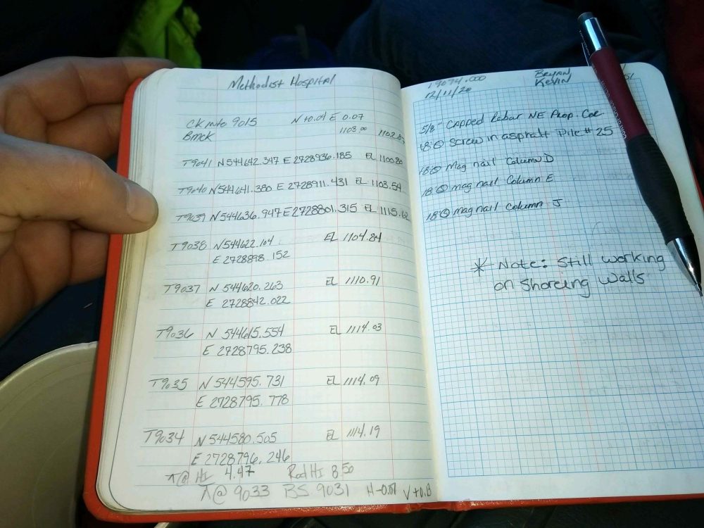
- Measurement: The size, length or amount of something. Surveyors measure property lines and construction elements. Surveyors most commonly use distance, angle, and elevation to measure the location of an object. New methods of measurement may use GPS satellite, drone or laser technology.
- Metes and Bounds: Literally, measurements and monuments. Surveyors describe a boundary using bearings, azimuths, distances but also by “calls” to existing landmarks or monuments. North 40° 50′ 08″ East, a distance of 102.00 feet to a chisel marked rock. The measurement is important but the chisel mark on the rock out-weighs the measurements. Repeated measurements may vary but the rock position holds as a monument along the boundary.
- Monument: A monument, for surveyors, is a structure built on a location as a permanent reference marker. The corners of sections (square mile) were “monumented” by original land surveyors laying out the Public Land Survey. Because the boundary lines would never move once they were set, it was important to mark the intersections in a strong way. Modern day surveyors look for those monuments to recover the original section lines.
- Offset: An offset is to move perpendicular to the line of reference. For example, two monuments mark a right-of-way line. The property line on the other side of the street can be found by offsetting the line by the width of the right-of-way.
- Plat: A plat is a drawing or map of property lines surveyed and monumented for others to find. A plat shows lots, streets, section lines or ties to section lines. It is a recorded exhibit of the boundaries created by the surveyor.
- Point of Beginning: Starting point for a property boundary description. The origin or point of beginning leads all who retrace a survey to the same location. The point of beginning is often tied to the Public Land Survey System so the legal description can be related to other legal descriptions in the same area.
- Public Land Survey: See Aliquot. The Public Land Survey System (PLSS) is the method of subdivision of government land west of the Mississippi River. As the United States was settled in the late 1800s by pioneers, primarily for agriculture, surveyors divided and marked the sections and then quarter sections. Per the Homestead Act of 1862, the U.S. government granted land to married couples up to 320 acres. Each adult citizen could claim 160 acres but had to pay filing fees and occupy it for five years, build a dwelling and cultivate the land.
- Redevelopment: Redevelopment in surveying refers to the process of improving and transforming urban areas that have experienced decay and deterioration over time. It involves constructing new buildings, structures, and land uses on a site with previous or existing uses
- Replat: Replat means the process of changing, or the map or plat which changes, the boundaries of a recorded subdivision plat or part thereof. The legal dividing of an outlot within a recorded subdivision plat without changing the exterior boundaries of the outlot is not a replat.
- Rezoning: Rezoning is a legal process that allows landowners to change the designated use of their property under local zoning laws. It can create opportunities for development or business expansion but involves detailed procedures and legal requirements.
- Right-of-way: A legal right of passage over another person’s land or property. An easement is technically a right of way but the term is more reserved for public highways, city roadways and other public use. An easement only benefits the grantee (maybe a utility company) but right-of-way benefits the public.
- Riparian: Relating to or situated on the banks of a river. Riparian boundaries are those related to the location of the water. It could be water’s edge referenced to an elevation, thread of a stream, or a moving water’s edge through accretion.
- Scanning for 3D Modeling: Modern surveying technology enables precise 3D scanning of object surfaces and elevations within a scene. The process captures three-dimensional coordinates alongside high-resolution photographic imagery. Through horizontal and vertical overlap, multiple scans are seamlessly stitched together to form a detailed composite of the environment in 3D.
- Senior Rights: At CNC Surveying, we utilize the Trimble SX-10 Scanner to deliver accurate measurements of inaccessible structures, support builders with pre-load verification, and provide thorough data for legal documentation.
- Site Due Diligence: Due diligence is a comprehensive and systematic process of investigation, analysis, and evaluation of a business, investment, or transaction. It helps identify and assess potential risks, liabilities, and opportunities to ensure informed decision-making and mitigate potential negative outcomes.
- Site Surveying: Site Surveying is required for an architect to design a house or a building. Site surveying is often done before selling and buying an improved piece of commercial property. Knowing where and what utilities and improvements are below and above the ground is vitally important prior to planning new improvements for any property.
- Special Use Permit: In Omaha, a Special Use Permit (SUP) allows certain land uses that aren’t automatically permitted in a zoning district but may be allowed if they meet specific criteria and go through a formal review process. A special use permit must be approved by Planning Board.
- Staking: Construction staking is an imperative phase during the building process. Builders depend on surveyors to locate positions on a construction site. The stakes are usually offset from the feature so it can be built without disturbing the staked reference marks.
- Subdivide: Dividing property that has already been divided. A subdivision is newly created lots through the process of platting. In a subdivision, all lots are conveyed simultaneously. This is an important point which determines how re-surveys are done by proportion rather than applying senior and junior rights.
- Subsurface Utilities Engineering: or SUE is a classification system citing the accuracy of different methods used to locate underground utilities and structures. This is important when new utilities designed may cross or otherwise interfere with existing underground utilities.
- Surveying: Accurately determining the three-dimensional position of objects and points on the Earth’s surface. The objects may be property boundaries, construction elements, highways or utilities. There are many different types of surveying, techniques and methods for surveying.
- Surveying Omaha: Land Surveying in Omaha is done by companies who specialize in land development and those who don’t. Costs are different because land development related work is done by larger companies with a higher management cost. Smaller companies like CNC Surveying LLC are more effective and customers receive quality work for less cost.
- Title: A right or claim to the ownership of a property or easement. Real estate is conveyed from one person to another using a deed, land grant. The use of property (without ownership) can be granted by the owner and title to that use (easement) is conveyed. Title companies collect ownership records in a summary called an abstract or title search.
- Topo: is short for a topographic map. A topo map shows elevations and locations of features and existing man-made changes to land. A topo map is used by civil engineers and architects to layout and design improvements to fit that land. For example, roadway widening requires a base layer of the existing road so the new road can be designed relative to the present conditions.
- Topographic: Relating to the arrangement or accurate representation of physical features of an area. Elevations are also shown by lines of equal elevation or contours.
- Topography: The arrangement of natural and artificial physical features of an area. Elevations are shown by contours (lines of equal elevation) so that slope conditions can be communicated to the map reader or designer.
- Transit: An old tool set on a tripod and used by surveyors to measure horizontal angles. Transits are still used today but they are more sophisticated and can be called theodolites or total stations. Total stations also measure distances, making it possible to determine the location of points with one instrument.
- Utilites: Services such a gas, water, electric, and communications are supplied by utility companies from the source or generation plant. Most utilities are buried underground these days. Their location and depth is important to designers making plans to cross existing utilities with new structures.
- Vacation: Removing an easement, Vacation in surveying refers to the process of removing an easement, right-of-way, or other encumbrance from a piece of land, freeing it up for another use. An example is vacating an ally or easement that is no longer used.
- Volume Quantity: Surveyors can determine the volume of large coal piles or contents of landfills. A more complicated calculation would be remaining volume to reach capacity for a landfill in progress. Another variation of that three-dimensional calculation is determining the excavation or fill dirt required to reach a grading plan. The two surfaces (existing topography) and proposed elevations (grading plan) are intersected in a software program. Volumes are typically reported in Cubic Yards.
- Zoning Board of Appeals: a standing committee of appointed members with expertise in zoning ordinances and land-use regulations. The board acts as a buffer between the property owner, or aggrieved applicant, and decisions made by the zoning enforcement officers and the State Supreme Court. The board’s primary purpose is to provide a fair and impartial forum for property owners and developers to challenge decisions made by local zoning officials. The ZBA is the only body authorized to make zoning text and zoning map interpretations, to hear appeals of administrative decisions, and to grant variances from ordinance standards where there is practical difficulty or unnecessary hardship meeting ordinance standards.
- Zoning Overlay: also known as an overlay district or zone, is a geographic zoning district layered on top of another existing zoning district. It is an additional layer of regulations that supplements traditional zoning regulations. It focuses on specific areas within a zoning district and addresses particular concerns, aiming to achieve specific planning objectives and enhance the quality and character of a community. An overlay zone encompasses one or more underlying zones and imposes additional or alterative requirements to that required by the underlining zone. An example is Area of Civic Importance or ACI.
- Zoning Variance: A zoning variance is an exception or deviation from the specific requirements of a zoning ordinance. It allows a property owner to use their land in a way that is not typically permitted under the existing zoning regulations. Variances can be sought for various reasons, such as economic hardship, unique characteristics of the property, or changes in circumstances. In Omaha, the Zoning Board of Appeals (ZBA) approves variance or waivers.
Glossary of Surveying Terms