
CNC Surveying has been fortunate to receive work from the City of Omaha for right-of-way surveying. Because of our Tier II Small Emerging Business status, and being a Woman-Owned Business, we have had the opportunity to show our quality and responsiveness in topographic and boundary surveying.
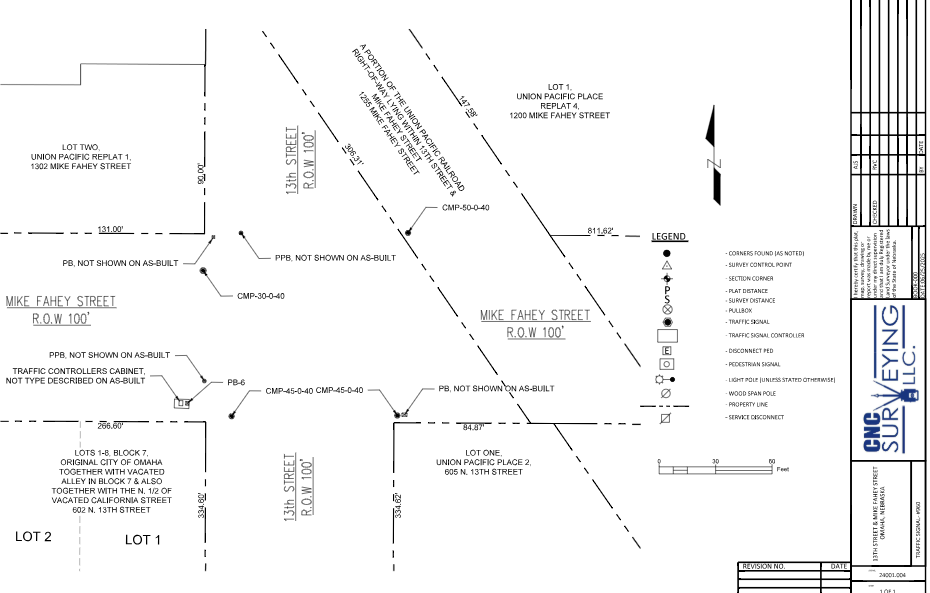
One of the contracts we have done is intersection surveying for traffic signals. We locate as-built features within the intersection such as street signs, manholes, utility pull boxes, power poles, plats, property lines and existing relevant easements. This information is used to write legal descriptions of new easements for signals required.
