<p>Topographic surveys are required for civil engineering, site planning, landscape design, layout, grading, and utility design. Contours and elevations are shown along with above and below ground improvements. This differs from ALTA surveys because legal documents aren’t typically searched and compared against the built environment. Also, ALTA surveys typically don’t show elevations unless flooding is an issue for the property.</p>
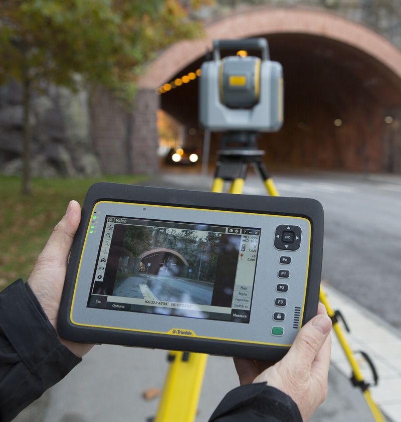
One of the most recent technologies available to surveyors is three-dimensional scanning. That is, remotely sensing the position and elevation of surfaces from control stations. We use Trimble SX-10 scanning total stations which photograph and measure scenes that are later merged together.
3D Scanning allows measurement of objects not reachable under normal conditions.
The constructed objects can be measured against construction plans or to determine deviations and fit with precision.
3D Scanning by CNC Surveying, LLC. Scanning the interior of an old building is an economical way to provide reliable dimension data to an architect.
Topographic Surveys in inaccessible areas such as busy intersections can be safely done.
Design
Scanning is useful in design situations when many built surfaces need to be considered. Existing building interiors can be modified with accurate location data. Existing pipe, mechanical, and electrical situations can be portrayed accurately in design software.
3D Scanning plant interiors and pipe assemblies can provide designers information to fit new piping into existing pipe assemblies.


